
The Ashburton River remains vulnerable, Environment Canterbury’s flood protection recovery manager Shaun McCracken says.
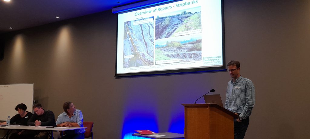
Mr McCracken is co-ordinating repairs from the 2021 flood event across Canterbury. He was in Ashburton to present at a public flood protection works meeting about Ecan’s work post-flood on the Ashburton River.
Flooding events from 2021 saw 209 identified work areas along the Ashburton River catchment at an estimated cost of $12m; 116 sites had been completed with $8.7m spent to date.
“The majority of the remaining work is tree planting and vegetation reinstatement,” he said.
Pole planting resumes in April.
There are 10,000 properties paying targeted rates toward the Ashburton River rating scheme.
The meeting, held at the Ashburton Event Centre, saw around 25 people turn out, including river rating committee members David Clark, Chris Allen, Wayne Muckle, Mick Hanham, chairman Mike Salvesen, council representative Neil Brown and Ecan representative Ian Mackenzie.
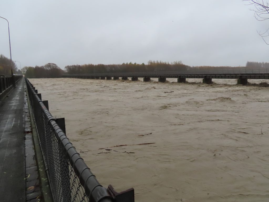
Mr McCracken said the Ashburton River scheme had 77km of stopbanks, and 280km of trees with a “fairly big asset value” and assets being protected of just under $5billion.
“It’s one of Canterbury’s bigger schemes but not the biggest,” he said.
The scheme objectives are to maintain the river beds clear of vegetation, to maintain the berm vegetation, to control erosion and reduce overflows. And, in sections of river with stopbanks, to design capacities to fit targets.
“We can safely say that the scheme is in a pretty vulnerable state at the moment after the damage that was sustained a year and a half ago,” he said.
Mr McCracken said all 10,000 properties in the Ashburton River rating district benefited from the scheme and would be affected if it was not in place.
Properties receiving more benefit paid proportionately more than those with lesser benefit.
“Damage from the 2021 flood and the repairs implemented to date span the full length of the catchment,” he said.
“It is all still vulnerable. However, the flood protection assets which protect the urban area of Ashburton and Tinwald were upgraded in the early 2000’s and are in a better condition than the rural portions of the scheme currently.”
He said the current design standard was to protect from a 200-year event in the urban area (0.5 percent annual exceedance probability) and a 50-year in the rural areas (two percent annual exceedance probability).
The 2021 flood tested the safety of the town.
“This was a big flood. The 2021 event was a true test for the upgraded Ashburton town stopbank scheme.
‘‘We stationed staff and response teams at critical locations of the flood protection system to monitor the infrastructure.
“Plans were being prepared to evacuate parts of the Ashburton township if necessary,” he said. “ Fortunately this was not required.”
It included houses across Allenton and further afield downstream of Jessops Bend, near Digby’s Bridge, where a breach from the river was likely due to a relatively constricted fairway, height of stopbanks and presence of historic flow paths.
Funds raised through targeted rates are a drop in the bucket on the true cost needed – along with good management – to prevent the river again breaching its banks affecting properties in its path.
In the 21/22 financial year “urban Ashburton (made up of approximately 5000 properties) would pay $3.73 per $100,000 capital value.
“So a $600,000 property would contribute $22.38 towards the flood protection scheme,” he said.
The river rating committee – made up of six to 12 people in the scheme – help to guide the management of the scheme.
They meet in a public forum every three years to refresh the committee.
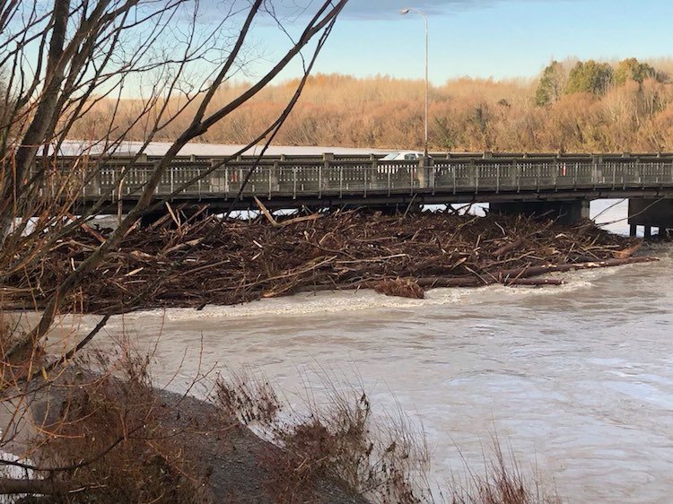
The Ashburton River flood in 2021 saw the north branch receive a best-estimate flow of 700cumecs.
“The water that was coming in exceeded the design capacity in the upper catchment.
‘‘It wasn’t until we got into the Ashburton urban area that we were just within that design capacity,” Mr McCracken said.
“As a result of that there were a lot of overflows, a lot of damage and that’s what we have been working on since.”
Along the Ashburton River catchment 209 identified work areas were identified at an estimated cost of $12m; 116 sites have been completed with $8.7m spent to date.
Mr McCracken said last year five reasonably big rainfall events exacerbated the damage in some areas of the Ashburton River and did around $200,000 worth of new damage.
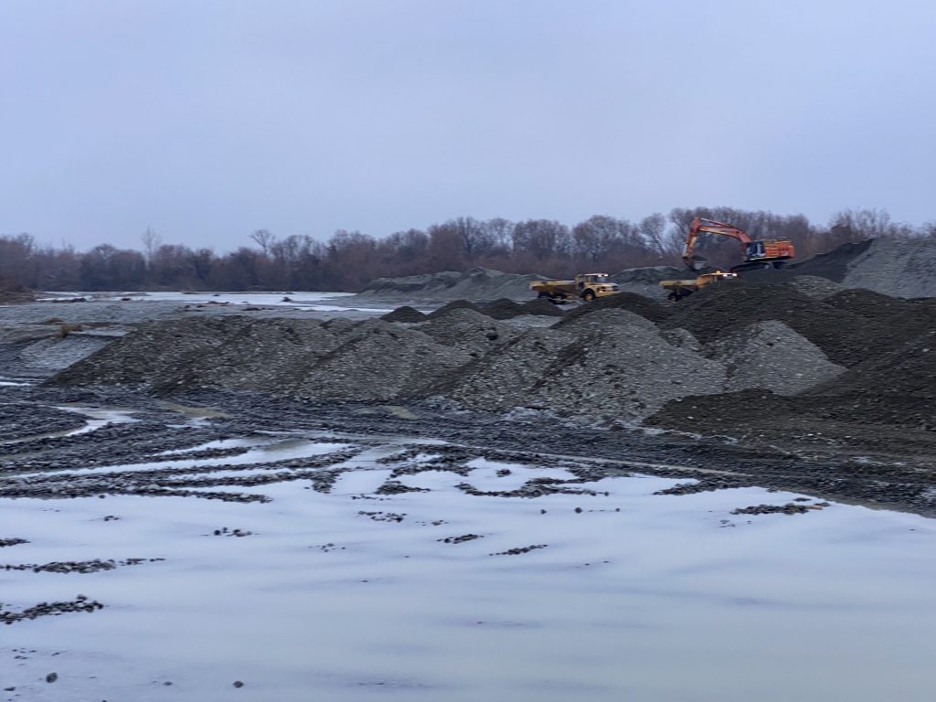
Repairs completed to date included temporary channel work, replace 1300m stock bank in the catchment, 14km of trees to be replaced, lots of fairway debris clearance to do and then ongoing maintenance of those repairs sites.
The initial cost estimate for the total Canterbury region was $20million, funded from Ecan general rates and co-funding with NEMA (the national Civil Defence agency).
All repair work across the region was being funded from outside the rating district, he said.
At the top of the catchment there were also some really big erosion bays – on the north branch in the vicinity of the Rangitata Diversion Race and the south branch above State Highway 72.
There are also a lot of snags or debris in the river.
Remedies include burning or harvesting where appropriate or replanting back into berms to use as an asset.


